

Palo Alto to the Pacific
Distance: Approximately 48 miles one way and includes two nights of camping.
Elevation change:
Gained:10,500 ft
Difficulty: Strenuous
Hiking time: Appx. 23 hours of hiking (assuming roughly a 30-minute mile pace) and two nights of camping.
Season: Summer is best (campsites are open roughly April to November)
Overview:
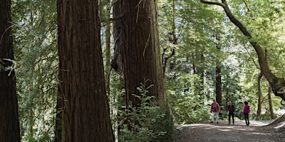
After camping under the stars at Monte Bello Open Space Preserve, we woke up to crisp morning air and long sunbeams peeking over the ridge, warming up the grassy slopes.
Each of us was excited for the day ahead and, with any luck, reaching the ocean by the end of the next day.
Our cross-Peninsula adventure was still a little less than half complete and we had some miles to move. Here’s where we went on day 2 and 3 of the trip:
Day 2:
Monte Bello Open Space Preserve
With the busy Bay Area in your rearview, take in the views of the Stevens Creek Watershed while you descend down the western slope of the Monte Bello ridge on the Indian Creek Trail.
Stay high in the basin by turning right at the Canyon Trail and left on the Stevens Creek Trail where you’ll cross the creek. Follow the Skid Road Trail for your final ascent up to Skyline Boulevard. Exit through Monte Bello’s gate 6.

Skyline Ridge Open Space Preserve
Watching for cars, carefully cross Skyline (Highway 35) into Skyline Ridge Open Space Preserve. Join a segment of the Bay Area Ridge Trail by following the Sunny Jim Trail toward Horseshoe Lake, then cross over the dam and join Tree Farm Trail.
This part of the preserve was a former Christmas Tree Farm and has recently undergone a 10-year restoration project to return it to a native plant community. Continue south along the Chestnut Trail, and then cross into Long Ridge Open Space Preserve.
Long Ridge Open Space Preserve
You’ll only see a small sign indicating you’ve crossed into Long Ridge OSP when you have. Continue on the Chestnut Trail (part of the Bay Area Ridge Trail) and onto the Peters Creek Trail.
When you reach Long Ridge Road, stay left on the Bay Area Ridge Trail toward Hickory Oaks Trail. One of the best views of the trip, you’ll know exactly why they call it Long Ridge. Turn right onto Hickory Oaks Trail and then stay on Ward Truck Trail to begin your descent into the redwoods. About a mile down the Ward Road, you will cross into Portola Redwoods State Park.

Portola Redwoods State Park
Shortly after entering Portola Redwoods, the Slate Creek Trail will veer off to your right. Follow it down the northern slope of the ridge to Slate Creek. This is a great spot to have a snack, address any blisters or just cool your feet off in the creek.
Use the stepping stones to cross, and proceed down the lovely redwood sorrel lined- creekside path that is the Slate Creek Trail. Continue onto the Summit Trail, as you follow the water drain down into Pescadero Creek. After crossing Pescadero Creek, and Old Haul Road, take advantage of Iverson Creek near the trailhead for Portola Trail and use your water filter to fill up your water bottles and gain your strength before heading up to Butano Ridge.
Pescadero Creek County Park
Once you cross over Old Haul Road, you’ll notice a sign at the trailhead indicating you are entering Pescadero Creek County Park. Be prepared for an incline, and follow the Portola Trail as you begin your ascent up the slope, then turning left to join the Butano Ridge Trail which seems to march right up the nose of a ridge. After a somewhat grueling uphill, follow the trail to the left toward the Basin Trail Easement.

Basin Trail Easement
Public and private partnerships are crucial to land protection and management. Roughly two miles of this trail cross right through privately owned land to connect two massive redwood preserves and hundreds of miles of trail in either direction.
Be aware of several private ranch roads that manage to meander back and forth across the trail easement, and keep your eyes open for signs to aid you in the direction you need to go and keep you on the path. You’ll reach Big Basin Redwoods State Park after crossing China Grade Road. End your day by setting up camp at the Lane Trail Camp.
Day 3:

Big Basin Redwoods State Park
Start your day following the Hollow Tree Trail as it follows the contours of the hillside and winds down through tanoak, madrone and into the redwoods. Keeping the hillside on your right, turn right onto Middle Ridge Road and then left onto Johansen Road toward Sandy Point. Stay right onto Whitehouse Canyon Road and follow it until you join Chalks Road. At Chalks Mountain Lookout you will be rewarded with nearly 360-degree views east and all the way out beyond Año Nuevo State Park. Continue along down Chalks Ridge following the sandy road until you join the Whitehouse Ridge Trail.
Año Nuevo State Park
At this point you’ll cross into the Cascade Ranch Unit of Año Nuevo State Park. Once you’ve joined the Whitehouse Ridge Trail, you’ll be afforded two more spectacular lookout view points as you descend down to the end of the trail at Whitehouse Canyon Road and Whitehouse Creek.
There is some parking at the trailhead but if you haven’t left a car here, you still have roughly 2.5 miles to travel on this dusty road until you reach Highway 1. Safely cross the highway to enter the Año Nuevo Coast Natural Preserve State Park. Follow the South Whitehouse Creek Trail to the bluff and make your way down the trail to beach access. Take off your shoes and dip your tired toes in the ocean. You’ve reached the edge of the continent!

Click here to find part 1 of this story.
More on Our Website


About Post
Peninsula Open Space Trust (POST) protects open space on the Peninsula and in the South Bay for the benefit of all. Since its founding in 1977, POST has been responsible for saving more than 89,000 acres as permanently protected land in San Mateo, Santa Clara and Santa Cruz counties. Learn more


