

Getting out of the house to enjoy the day can be a challenge if you don’t have a car. Fortunately, here in the Bay Area, we have a robust network of public transit options. In fact, San Francisco ranks
second in the U.S. for best public transportation system, right behind Washington D.C. Moreover, the city ranks first in the lineup of most walkable US cities. So if you don’t have a car, don’t worry. Trust me, I’ve learned that there’s more than one way to get around.
Right before I moved from Los Angeles to San Francisco, I sold the 1997 Toyota Camry that had carried me for many years across the freeway landscape of Southern California. It was old, having problems, and I honestly didn’t think it could make it up the steep streets of SF.
But adjusting to life without my beat-up green jalopy proved to be much easier than anticipated. After a couple of weeks commuting to work, exploring the city, and taking day trips via buses, trains, and light rails, I’d learned how to use the transportation system not only for my needs, but for my enjoyment as well. I even learned how to get far enough out of the city to enjoy a hike.
Here are some routes I have taken on public transportation to access hikes in the Bay Area, startingin three different locales: San Francisco, San Jose, and East Palo Alto. I hope you will enjoy the journey as much as I did!
 BUT FIRST: THE MUST-HAVE PUBLIC TRANSPORTATION APP
Unless you have every bus line memorized citywide, you should have the Transit app on your phone.
Transit is free to download, and a must-have tool for navigating public transit. Simply type in your destination, and it will tell you the quickest, most effective transit route. Not only does it show you which bus to take, but also directs you to the closest stop, and shares live updates on when the next bus will arrive.
Moreover, the app lets you provide feedback on your transit experience. You can rate bus cleanliness, crowdedness, wait times, and more. Transit shares this feedback with local transportation agencies, who can then work to improve the system based on user feedback.
Lands End — San Francisco
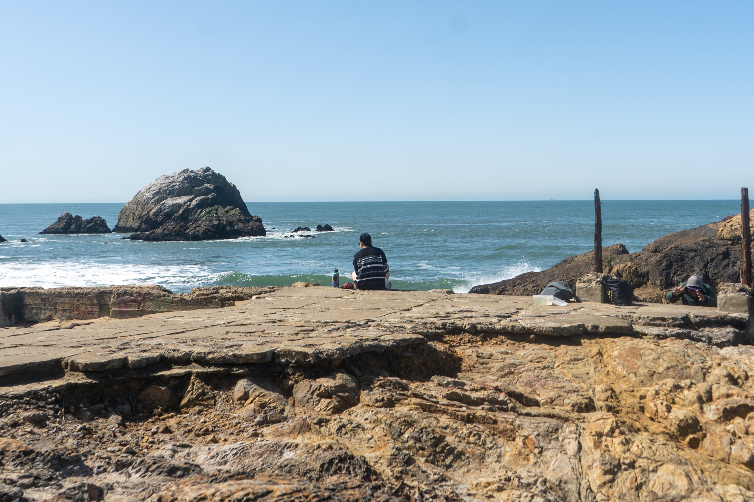
When the sun comes out in frequently overcast San Francisco, it beckons us locals outdoors. Especially as there are a plethora of hiking trails with stunning views that you can access in under an hour.
For this particular hike, from Lands End to Golden Gate Bridge, I began my journey at the SalesForce Transit Center, a hub for many buses going in many directions. Using my trusty
Transit app, I plugged in my destination, which was Lands End, and the app instructed me to take the 38R bus. After boarding the 38R, I relaxed for about forty minutes as we rumbled across the city, through various neighborhoods. The bus dropped me off right across the street from the Lands End Lookout — the very last stop. Here, I began walking north on the California Coastal Trail, officially starting my hike.
The hike winds through Cypress groves, over old military batteries, past bustling beaches, and eventually finishes at the southern end of the Golden Gate Bridge.
Ready to go back, I waited for the 150 Bus (per Transit’s directions), which comes directly off of the bridge and heads back east, ultimately stopping at the SalesForce Transit Center. I ended the day exactly where I started, satisfied from a scenic, refreshing hike. All executed without a car!
Los Gatos Creek — San Jose
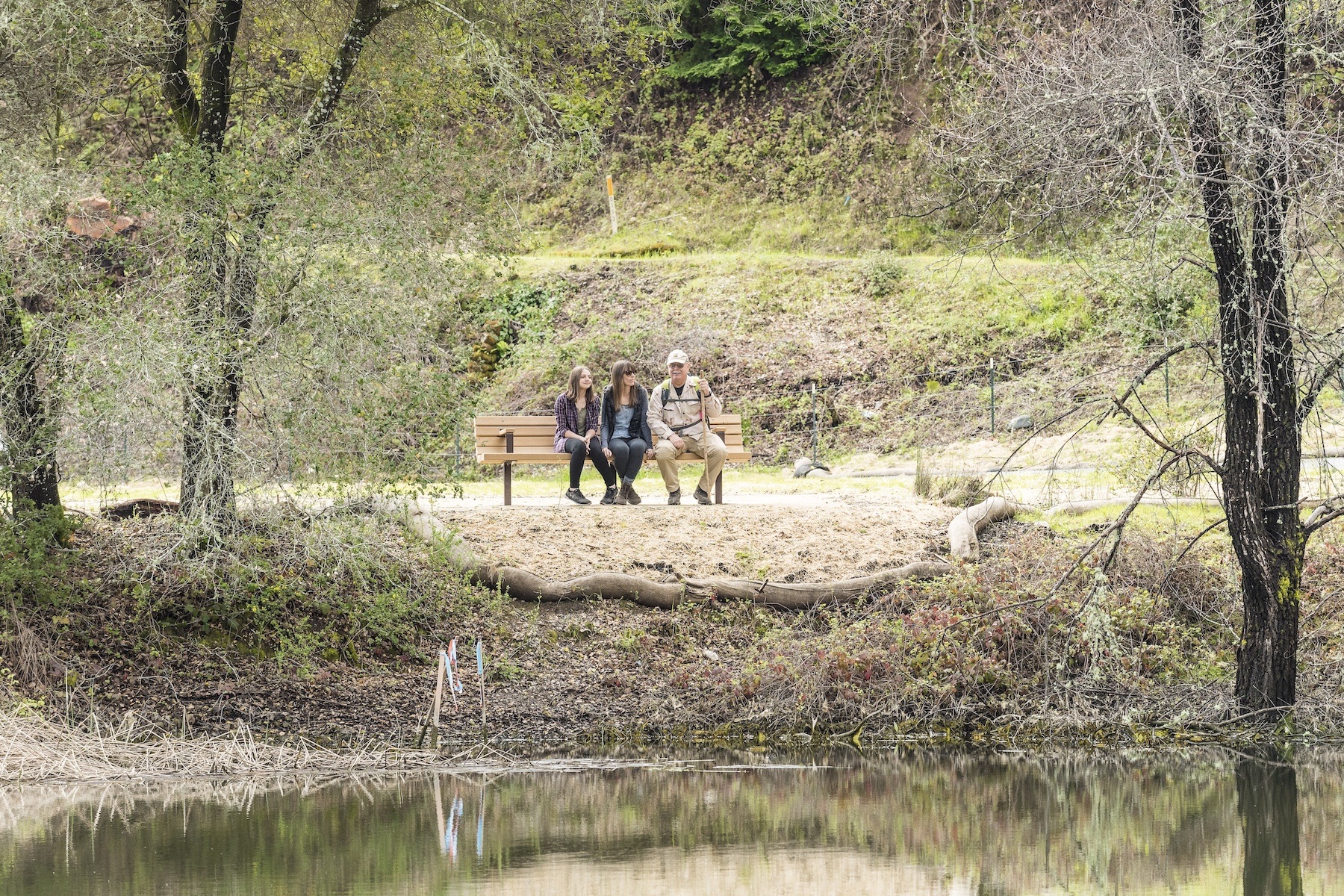
There are many great places to hike around San Jose, but admittedly, many are a challenge to get to using only public transportation. Fortunately, after some research, I found that the Los Gatos Creek Trail is super accessible via bus. There’s an entrance to this creekside path directly off of the bustling Main Street in downtown Los Gatos. Yet just a few yards into the hike, you feel immersed in nature.
I began this journey at Diridon Transit Center, which has many bus connection options. Here, I easily caught the Green Line light rail heading toward Winchester. I rode this quiet, comfortable train for just about 10 minutes before it reached its final stop at Winchester station. The next leg of my journey was on the southbound 27 bus, which luckily picked up right there at the station. I didn’t have to walk more than 100 feet to hop on the 27, its electronic sign signaling that it was heading toward the Santa Teresa Station. Once it departed, I rode for about 20 minutes before hopping off at the Main Street and Santa Cruz Avenue stop. Then, it was a short three minute walk down Main before I found the entrance to the trail.
The trail takes you down from street level to creek level and lets you amble along among a lot of greenery until you begin to climb up a path toward Saint Joseph’s Hill.
The trail circles back on itself, so I exited at the same spot I’d entered and began retracing my transit steps. I caught the northbound 27 bus heading towards Winchester at the same intersection of Main and Santa Cruz. Once I disembarked at Winchester Station, the Green Line train heading toward Old Ironsides was waiting; I hopped on, and headed back homeward.
Cooley Landing — East Palo Alto
Did you know that East Palo Alto has an on-demand shuttle service within city bounds, and that it costs only $2.50 to ride? It’s true, and it makes accessing a hike without a car easy. The SamTrans Ride Plus shuttle can be ordered using the app, or simply by calling (650) 238-5880. Note: the shuttle can be busy, so it’s best to schedule ahead.
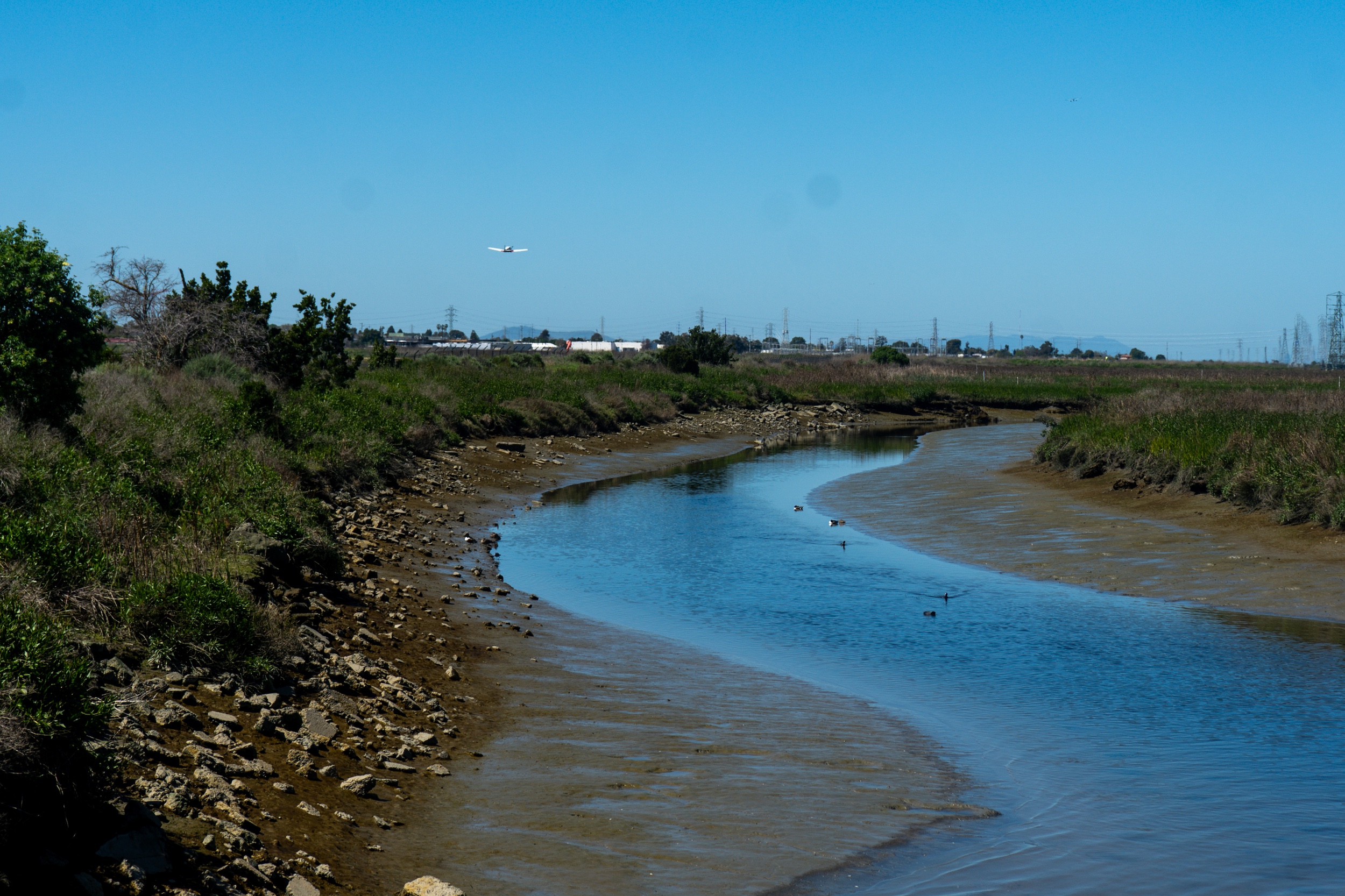
To get to my hike along the Cooley Landing Trail, I ordered a RidePlus shuttle from my starting point near City Hall. It arrived about 10 minutes later, and I got on, paying with my Clipper card, which is the reloadable transit card used for fare payments throughout the Bay Area. The driver took me to the destination I had specified, which was Martin Luther King Jr. Park. I spoke to the friendly driver along the way. He shared that many kids utilize the shuttle service to get home from school, so wait times for shuttles tend to be longer in the afternoons.
I disembarked at the park, which connects to the Bay Trail just behind the baseball field’s outfield fence. I followed this for a few hundred feet before officially starting down the Cooley Landing Trail. I passed a small airport and saw little planes taking off, plus many herons stalking the baylands. I even explored the small Lucy Evans Baylands Interpretive Center.
The trail loops back on itself, so once I was back at Martin Luther King Jr. Park, I called another Ride Plus shuttle…unfortunately, I found that I should’ve listened to the driver’s advice and booked ahead. It was a busy time, and the wait was an hour long. Pivoting, I used the Transit app to find an alternate route back. It instructed me to walk a few blocks inland to catch the 280 bus heading back toward City Hall. I chose this option, and caught the bus to wrap up my excursion.
I once felt scared to use a bus, because I was so accustomed to driving around in the comfort and safety of my own vehicle. Parting ways with my car has turned out to be an enriching experience. There is a transit system in place for a reason, and it’s designed to serve the people; to increase community connection and awareness. Everyone should feel empowered to take advantage of the transit around them to go where they want, because car or no car, everyone deserves to enjoy the outdoors around them!
Featured
View All NewsAbout Post
Peninsula Open Space Trust (POST) protects open space on the Peninsula and in the South Bay for the benefit of all. Since its founding in 1977, POST has been responsible for saving more than 89,000 acres as permanently protected land in San Mateo, Santa Clara and Santa Cruz counties. Learn more


