

What makes San Francisco an ideal location for an urban hike? Let me count the ways. From the bluffs to the beaches to the mountain peaks, it’s a joy to get outside and see the awe-inspiring views of our unique landscape. In a city like this one, where the land meets the sea on three different sides, many great trail networks are right at your boot soles. Plus, you’ll spot historic landmarks, climb scenic staircases, and cool off in the mild climate.
Here are five fantastic hikes that we recommend in the City by the Bay. Take a peek and see what calls your name…we’re confident that there’s a trail for everyone in this special city, where urban and natural settings happily coexist unlike anywhere else in the U.S.
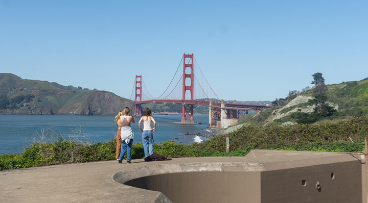
1. Batteries to Bluffs Trail
This trail is aptly named, as it winds along the natural curves of San Francisco’s west bluffs, revealing stunning views of the Pacific Ocean while taking you across several abandoned batteries from former military outposts. These civil-war-era batteries thankfully never saw battle; today, they are covered in graffiti and make for interesting scenery against the backdrop of the Golden Gate Bridge and distant Marin County. The trail extends from Baker’s Beach to Marshall’s Beach, and though not very long, it involves many stairs. You can get to the trail from the Baker’s Beach parking lot via a short walk along the California Coastal Trail. If you’d like to extend the hike, you can continue along the Coastal Trail in either direction.
Distance: 2.3 miles
Elevation Change: 446 feet
Hiking Time: 1 hour
Managing Agency: National Park Service
Parking Location: Click here for directions.
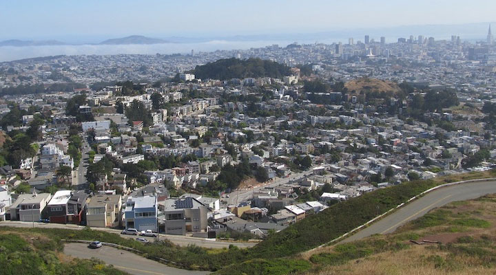
2. Twin Peaks Loop
The trip to the top of Twin Peaks is a quintessential San Francisco hike. The peaks are positioned in the middle of the city and the top affords unobstructed views in every direction, including the sea and bay beyond. It’s a popular trail, so expect to see many others enjoying a hike as well; but if you’re in San Francisco with limited time, this is the hike to hit.
P.S. If you’re looking for a longer and more strenuous hike, this trail connects to the Mount Sutro loop. When done together, you get a 4.3-mile tour of the city’s famous peaks — with an elevation gain of over a thousand feet!
Distance: 2.1 miles
Elevation Change: 272 feet
Hiking Time: 1 hour
Managing Agency: San Francisco Recreation and Parks
Parking Location: Click here for directions.
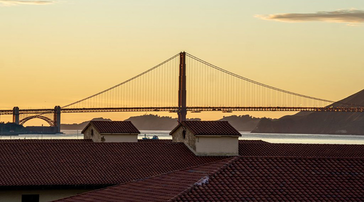
3. Fort Mason to Fort Point
Take in the views of the bay and the city skyline from the top of Fort Mason. You’ll also have the chance to explore old military housing and offices, which now function as the park headquarters for the Golden Gate National Recreation Area. From here, wind your way down to sea level and begin a leisurely walk along the Marina Green, past the bustle and charm of Crissy Field beaches, across marshes teeming with seabirds, to eventually reach the historic Fort Point, an old military outpost with arguably the best view of the Golden Gate Bridge. This hike is not very physically taxing and is more urban than the others on this list — perfect for a casual stroll on a sunny day!
P.S. This walk follows the Northern Waterfront section of the extensive Bay Trail. If you’re looking for a longer hike, you can push the starting point back to the Ferry Building or Oracle Park — just be prepared for sidewalks rather than dirt trails!
Distance: 2.9 miles
Elevation Change: 134 feet
Hiking Time: 1 hour
Managing Agency: National Park Service
Parking Location: Click here for directions.
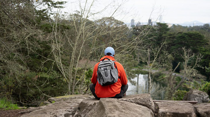
4. Golden Gate Park Loop
One of the greatest things about San Francisco is the extensive, beautiful, extremely rectangular Golden Gate Park. Stretching in a neat formation from Ocean Beach to the “panhandle” of the Haight, Golden Gate Park contains everything from art museums to polo fields to lawn bowling lanes. The park is so massive that it’s easy to forget you’re in the middle of a city. Some areas are so heavily forested that you can hike for 10-15 minutes and feel entirely immersed in nature! This loop trail takes you through the many varied areas of the park, past museums, monuments, eucalyptus groves, and more.
Distance: 6.9 miles
Elevation Change: 370 feet
Hiking Time: 2.5 hours
Managing Agency: San Francisco Recreation and Parks
Parking Location: Click here for directions.
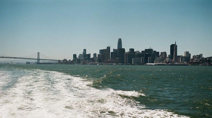
5. Angel Island
Okay, so Angel Island technically isn’t in San Francisco. Instead, it’s right offshore, and for the stunning views and uniqueness of the experience, it fits right in on this list. Plus, getting there is the best part of the journey. Ferries to Angel Island leave regularly from the Ferry Building Terminal. Tickets are $9.25 with a Clipper card. For this price, you get to sail across the Bay and take in views of the city, its bridges, and Alcatraz Island. Upon arrival, the perimeter trail promises 360˚ views of the Bay. You’ll pass several fascinating stops along the way, such as a Cold War era missile site and Civil War era batteries, with plentiful signage for you to learn about the island’s complex history.
Distance: 6 miles
Elevation Change: 488 feet
Hiking Time: 2 hours, 15 minutes + boat travel
Managing Agency: California State Parks
Parking Location: Click here for directions.
When you’ve got the itch to take a hike, this city doesn’t disappoint. It would be a waste to let its diverse terrain go unexplored, which is why I’m so grateful for these many trails that offer breathtaking views and make me so glad to live in San Francisco.
Featured
About Post
Peninsula Open Space Trust (POST) protects open space on the Peninsula and in the South Bay for the benefit of all. Since its founding in 1977, POST has been responsible for saving more than 89,000 acres as permanently protected land in San Mateo, Santa Clara and Santa Cruz counties. Learn more


