

Since our founding in 1977, POST has worked to safeguard open spaces on the Peninsula and in the South Bay. More than four decades into this work, we’ve preserved over 86,000 acres of land – open spaces that are now yours to explore.
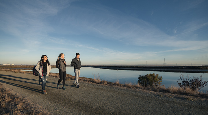
As POST’s public access program manager, I lead the organization’s efforts in planning regional trails. These long-distance routes connect multiple open spaces and unite our network of protected land. For me, it is deeply gratifying work. Regional trails are an avenue by which we create deep, meaningful relationships with our stunning landscape. When we spend time on these protected lands, we nurture our physical and emotional wellbeing.
Many regional trails create crucial spaces for people to connect with nature near urban areas. This helps to fill an important need across the state. According to California’s Outdoor for All initiative, one in four Californians lack a public park or open space within walking distance of their home.
We currently support the completion of three regional trails on the Peninsula and in the South Bay. I’m excited to share some more details on these trails, their history and POST’s involvement in these projects. There’s a lot to be excited about.
Here are the three regional trails we are working to help complete:

1. California Coastal Trail
Overview: Once complete, the California State Coastal Trail will parallel the state’s entire coastline. In 2023, a feasibility study was completed on the 18 miles of unbuilt trail in southern San Mateo county. Conducted by POST in partnership with Caltrans and many regional partners, this study focused on discovering trail route options, determining costs, and understanding how local communities will want to use the new section of trail. For more information about the study results and next steps, contact Bryanna Whitney at [email protected].
Distance once complete: 1,200 miles
Percent complete: 50% in San Mateo County
Managing agency: The overall vision and implementation of this trail is led by the California Coastal Conservancy, a non-regulatory agency that works to protect the state’s coastal resources. However, numerous public agencies, such as California State Parks and the City of Half Moon Bay, manage segments of the trail in San Mateo County.
POST’s involvement: POST has protected numerous properties on the San Mateo coast that now support the California Coastal Trail, most notably Pillar Point, Wavecrest, Cowell Ranch and Pigeon Point. Most recently, we safeguarded Tunitas Creek Beach, which offers the potential to close a gap in the trail south of Half Moon Bay.
To get a sense of the landscapes this trail will traverse, we recommend checking out the Jean Lauer Trail. This is an easy hike with low grades and beautiful views of a coastal wetland.

2. Bay Area Ridge Trail
Overview: The Bay Area Ridge Trail encircles the entire Bay Area, connecting the high points and ridges. 400 miles of this lengthy route exist so far.
Distance once complete: 550 miles
Percent complete: 73%
Managing agency: There is a consortium of land management agencies in all nine Bay Area counties working to complete this trail, and the Bay Area Ridge Trail Council is the group leading the charge to plan this trail.
POST’s involvement: POST has protected thousands of acres of ridgeline in the Santa Cruz Mountains that host 20-miles of the Bay Area Ridge Trail. A few examples include Russian Ridge and Windy Hill (our first acquisition) just to name a few. As with each of these projects, we continue to look for opportunities in our working area to support the completion of this regional trail.
There are plenty of options for hiking, mountain biking, trail running and horseback riding along the planned route. Check out the trail maps below for additional information.

3. Bay to Sea Trail
Overview: The vision for the Bay to Sea Trail is to create a continuous trail experience from the San Francisco Bay across the Peninsula to the Pacific Ocean. Once complete, this multi use trail — for walkers, hikers, bikers and equestrians — will also connect the urban areas of East Palo Alto, North Fair Oaks and Redwood City with the open spaces in the Santa Cruz Mountains. It will also connect to four other regional trail networks. We envision the eastern end of the trail would begin at both Redwood City’s Bair Island and the Ravenswood Open Space Preserve in East Palo Alto.
Distance once complete: 40 miles
Percent complete: The trail alignment is still very conceptual, however, it is estimated as much as 80% may be routed on existing and planned trails.
Managing agency: Eleven public agencies, municipalities and private nonprofit organizations are supporting this vision. Much of the trail will cross POST-protected Purisima Creek Redwoods Open Space Preserve, now managed by the Midpeninsula Regional Open Space District. This trail is in the early stages so please stay tuned to learn more.
POST’s involvement: POST is actively working to complete this trail by acquiring land to close trail gaps, leading agency collaboration and supporting the planning of critical urban trail connections through communities like Redwood City, North Fair Oaks and East Palo Alto.
POST-protected Bair Island will be a starting point on the eastern end of the trail. Located east of downtown Redwood City, Bair Island offers a flat hiking trail with must-see views of the bay.

BONUS: Coyote Creek Trail
Overview: San Jose’s Coyote Creek Trail extends from the San Francisco Bay to the city’s southern boundary and then into Santa Clara County-managed land, winding its way through the heart of Coyote Valley.
Distance once complete: 30 miles
Percent complete: 70%
Managing agency: The City of San Jose Parks, Recreation and Community Services Department and Santa Clara County Parks and Recreation Department manage this trail.
Here’s our recommendation for a 4-mile hike that begins just south of San Jose. This route is great for hikers of all ages, and pups are allowed on a leash!
Enjoy a Family-Friendly Outing
BONUS: San Francisco Bay Trail
Overview: This trail encircles the bay and welcomes hikers, joggers, bicyclists, skaters and wheelchair users. Once complete, it will traverse 47 cities, 7 toll bridges and 130 parks.
Distance once complete: 500 miles
Percent complete: more than 70%
Managing agency: Metropolitan Transportation Commission and the Association of Bay Area Governments
With so many entry points to choose from, you can find a destination to fit your unique recreation needs. Here are five options to check out at your leisure.
Learn more about our public access program here.
More Stories
About Post
Peninsula Open Space Trust (POST) protects open space on the Peninsula and in the South Bay for the benefit of all. Since its founding in 1977, POST has been responsible for saving more than 89,000 acres as permanently protected land in San Mateo, Santa Clara and Santa Cruz counties. Learn more


